GeoNET. Maps & Friends 12.0.253
Free Version
Publisher Description
GeoNET. Maps & Friends - Talk and drive with free OpenStreetMap maps
Maps
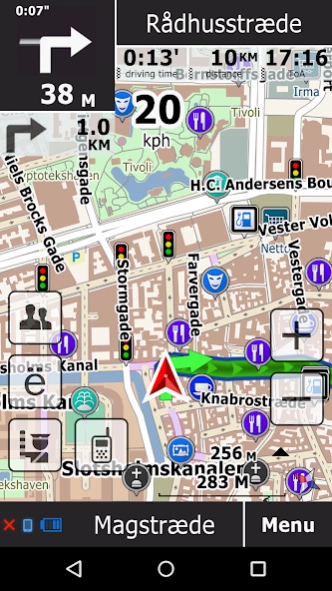
Almost every navigation software description starts with functions enumeration. In fact Navigation is maps, as everything or almost everything depends on map quality and use conditions. You are satisfied with the navigator just so much as the maps meet your tasks and needs. Usually publishers are “linked” to the data supplier that often determines the navigation quality. Meanwhile there are lots of map data types with different purpose, price, usage conditions, quality, and availability of extra services, based on such data and so on. There are drive aimed maps, as well as maps for pedestrians and bicycles, there are traffic information enabled maps, also there are some maps featuring detailed sightseeing information. All the above maps may be free of charge as well as payment based. The software enables choosing and rating maps from different sources and by different publishers, we have in our catalogue:
★ OSM maps – these are free of charge maps by OpenStreetMap project.
★ HERE maps – these are licensed maps by Nokia.
★ CityGuide maps – these are maps from local map makers; these maps are compiled and brought to the uniform standard. The major part of these maps is regularly revised and features traffic services. License terms and conditions are specified by the data owners and usually provide trial period and in some cases free of charge use in non-navigational mode.
All maps are provided with brief description and rating. You may choose and use maps from different sources; the software built-in catalogue will ensure map coverage of the actual user position. In other words you may simultaneously use different maps for the same country and region choosing those that suit you the best.
Traffic jams, navigational messages and updates
Another important feature of the gps navigator is instant navigational messaging service between drivers. Should you be a witness of a road accident, mobile station of traffic police, danger on the road, traffic jam, you may mark this event on the map. Information about all events will be automatically sent to all drivers of the region. Similarly you receive such messages from other drivers. Besides the software automatically gathers and sends to the server data about vehicle speed while you moving along your route. After this the data is processed on the cloud and sent back to the drivers who are involved in traffic data exchange as a traffic data containing file that enables generation of an optimal route allowing to bypass traffic jams. Some maps support revision service; it means that data about road circulation change, new restricting signs, speed limits etc. automatically received ensuring creation of quickest and safest route.
Functions
★ The navigator given with the whole navigational functions to work with a map, route creation, on route driving. You will find more detailed description of the navigator in our Google+ community https://plus.google.com/communities/106961068847641379802 . Here we only mention some key features.
★ The software enables choosing and using maps from different sources. In such a case you can choose the map that suits you the best.
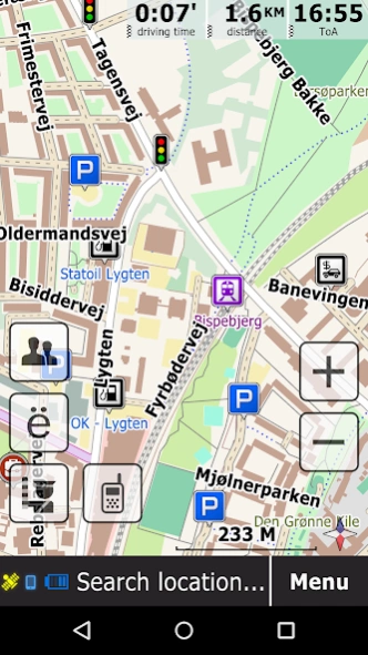
★ The software uses lightweight vector maps and can be used in offline mode without web access. In online mode it generates very little traffic for updates and IM service.
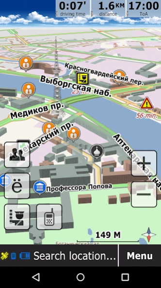
★ The software uses high-efficiency map library featuring high speed rendering, 3D graphics and 3D models.
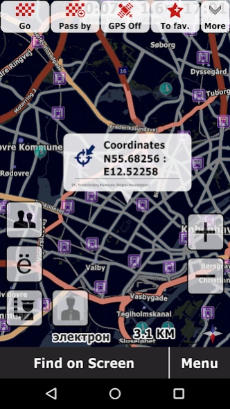
★ The software quickly generates routes.
★ The software generates the optimal route taking in account revised data and traffic. The driver may choose one of the alternate routes that are also generated by the software.
★ The software features improved search enabling search for address and POI using different criteria: search everywhere, search all, search address, search within region.
★ GeoNET navigator features unique communication functions - Push-To-Talk live chat, you can drive and talk with your friends on a map.
About GeoNET. Maps & Friends
GeoNET. Maps & Friends is a free app for Android published in the Geography list of apps, part of Education.
The company that develops GeoNET. Maps & Friends is GEOPHONE GROUP INTERNATIONAL Oy. The latest version released by its developer is 12.0.253.
To install GeoNET. Maps & Friends on your Android device, just click the green Continue To App button above to start the installation process. The app is listed on our website since 2023-02-02 and was downloaded 1 times. We have already checked if the download link is safe, however for your own protection we recommend that you scan the downloaded app with your antivirus. Your antivirus may detect the GeoNET. Maps & Friends as malware as malware if the download link to net.probki.geonet is broken.
How to install GeoNET. Maps & Friends on your Android device:
- Click on the Continue To App button on our website. This will redirect you to Google Play.
- Once the GeoNET. Maps & Friends is shown in the Google Play listing of your Android device, you can start its download and installation. Tap on the Install button located below the search bar and to the right of the app icon.
- A pop-up window with the permissions required by GeoNET. Maps & Friends will be shown. Click on Accept to continue the process.
- GeoNET. Maps & Friends will be downloaded onto your device, displaying a progress. Once the download completes, the installation will start and you'll get a notification after the installation is finished.
